Thursday, October 11, 2012
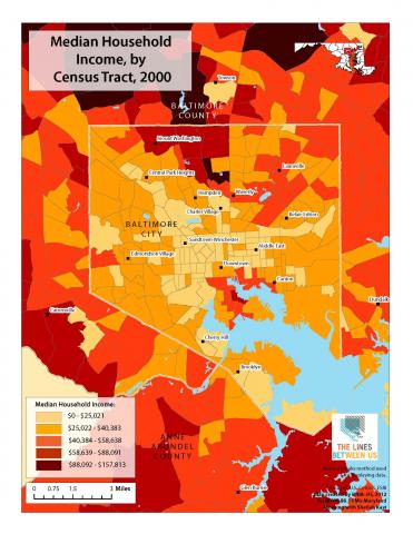
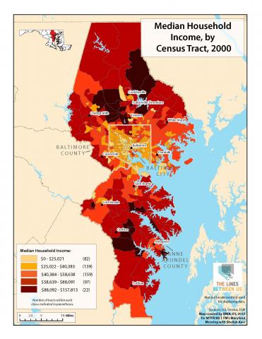
Today we're releasing another map created for "The Lines Between Us" by the Baltimore Neighborhood Indicators Alliance.
It's median household income by census tract in 2000.
Yes, 2000.
We'll release the 2010 map early next week. Between now and then, we want to hear how you think things have changed.
Take a look at the 2000 map. Do you think your neighborhood's income level has risen? What about your county? The region?
And do you have a story about how your neighborhood has changed?
Answer any of these questions through our contact page, and we'll share some of them next week.

