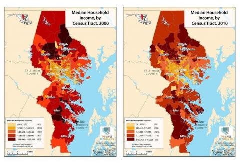
Earlier, "The Lines Between Us" published Baltimore Neighborhood Indicators Alliance maps showing median household income by census tract...in 2000.
Today, we publish the 2010 maps. Take a look. How has income changed in your neighborhood? How does it compare to other parts of the region? And how has it changed over the past decade?
And do you have a story to tell us about your neighborhood? Tell us through our contact page, and we'll share some of them on air or online.

Larger versions for these maps are here: 2000, 2010.

Larger versions for these maps are here: 2000, 2010.